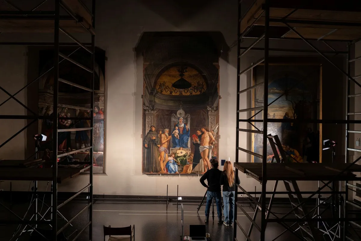
Finding an old map can feel like discovering a new world. At UC Berkeley's Earth Sciences & Map Library, this feeling is common. Karen Pfeffer, a library supervisor, notes the thrill of touching an original document.
Susan Powell, the GIS and map librarian, says these maps help students see them as more than just objective pictures. Maps are artifacts shaped by choices about what to show. This often leads to "aha moments" for students.
Pfeffer and Powell picked five vintage maps that offer a unique look at Berkeley. These maps show what the campus and city once were, what they almost became, and what they are still becoming.
We're a new kind of news feed.
Regular news is designed to drain you. We're a non-profit built to restore you. Every story we publish is scored for impact, progress, and hope.
Start Your News DetoxA Look at Berkeley's Past
A 1910 campus map is a detailed record of trees. It was likely hand-drawn and lettered by the university's Division of Forestry. Each tree is marked with a letter for its species. Powell points out that early aerial photos show fewer trees, suggesting the university actively shaped the environment. Today, students studying landscape design still use this map.
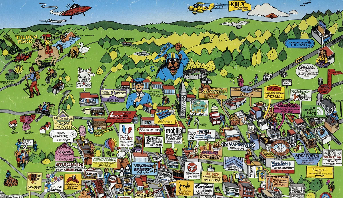
A colorful, cartoon-style map from 1985 shows Berkeley businesses during the "big-hair era." Powell calls it a "treasure hunt" for those who remember old shops and restaurants. The Cal campus is at the top, with Oski waving a pennant over the Campanile. A Daily Californian truck drives up Cedar Street. Some businesses, like Pegasus Books, are still around. Others, like Sweats Aerobic Studio, are now just memories.
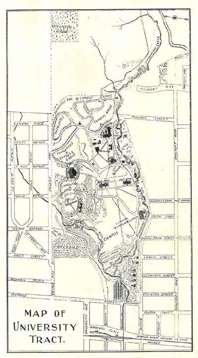
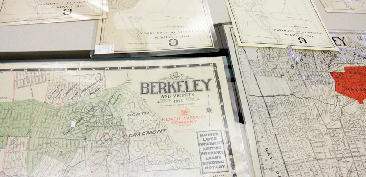
This black-and-white map from 1901 comes from Illustrated History of the University of California. It shows the campus about 25 years after moving from Oakland to Berkeley. You can see early gyms, sports fields, and eucalyptus trees. The buildings are labeled in elegant script, possibly hand-lettered. It captures Cal before it grew into the large university it is today.
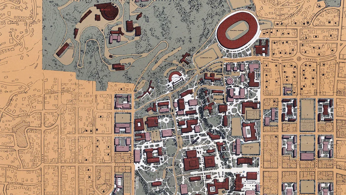
The 1962 Long Range Development Plan shows UC Berkeley's vision for the future. This color-coded map outlines buildings, landscapes, and pathways with midcentury optimism. Some plans came true, like Evans Hall and Moffitt Library. Others did not, such as an engineering complex planned for the current School of Journalism site. Powell finds it interesting to compare what was built versus what wasn't. This map reminds us that the campus is always changing.
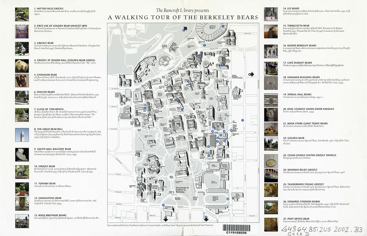
A 2002 walking tour map, created by The Bancroft Library staff, highlights over two dozen bear figures across campus. These include sculptures, stuffed animals, benches, and building ornaments. Pfeffer says this map turns bear-spotting into a fun scavenger hunt. Most bears are still in their original spots, but some have moved or disappeared. In 2018, the UC Berkeley Library shared a digital version of this hunt, showing that the campus's bear obsession continues.