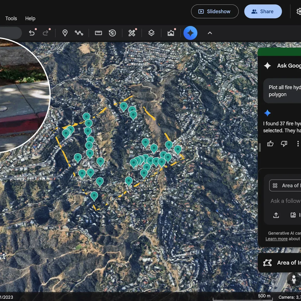
Google's Ask Google Earth platform just got a significant upgrade: it can now spot specific infrastructure objects—fire hydrants, traffic lights, utility poles, street signs, storm drains—across defined areas of a city, and pull Street View images to assess their condition.
The feature, announced last year and now integrated into Google's BigQuery analytics platform, solves a real problem for cash-strapped cities. A city planner trying to budget for road sign repairs no longer needs to manually survey streets. Instead, they can query the system to identify exactly how many signs need attention and where they're located. The same logic applies to utility poles showing wear, streetlights that are out, or hydrants that need maintenance.
Why this matters now
City infrastructure in the U.S. just earned its highest grade ever from the American Society of Civil Engineers—improving from a C- in 2021 to a C in 2025. That's genuine progress. But there's a catch: according to a 2025 National League of Cities survey, infrastructure dropped from mayors' top two priorities to fourth place. The culprit is familiar: cities are squeezed by tariff impacts, bond market issues, and shrinking federal funds from the 2021 Infrastructure Investment and Jobs Act.
We're a new kind of news feed.
Regular news is designed to drain you. We're a non-profit built to restore you. Every story we publish is scored for impact, progress, and hope.
Start Your News DetoxWhen budgets tighten, data becomes currency. A city planner who can instantly quantify exactly how many broken streetlights exist in a neighborhood can make a more convincing case to council members for targeted spending. They're not guessing. They're not hoping. They're showing the math.
Google's pitch is straightforward: do more with less. The platform lets planners optimize which repairs to tackle first, which streets to prioritize, and how to allocate limited funds across competing needs. It's not flashy infrastructure investment—it's the unglamorous work of making existing systems more efficient.
The real value isn't in the technology itself. It's in what happens when a city has clear visibility into its own assets. A pothole that gets documented is a pothole that might actually get fixed. A utility pole marked as deteriorating becomes a scheduled replacement instead of a crisis waiting to happen.
As cities navigate tighter budgets and aging infrastructure, tools that turn sprawling datasets into actionable priorities could become essential infrastructure themselves.