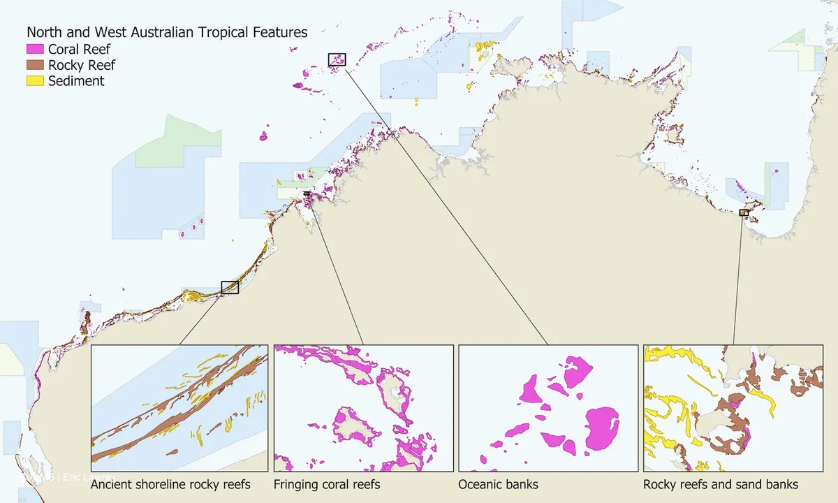
Turns out, Australia's northern coast was hiding a secret: over 1,000 previously unmapped coral reefs. That's a lot of real estate that scientists just didn't know about, even if local communities probably had a good hunch. It's like finding a whole new wing on a house you thought you knew inside and out.
Leading the charge was Eric Lawrey from the Australian Institute of Marine Science (AIMS), who noticed some suspiciously reef-shaped blobs lurking in satellite images. The catch? These were in seriously murky, sediment-filled waters. A single satellite picture just showed what he called "turquoise paint," effectively blurring everything into an aquatic impressionist painting.

So, Lawrey got clever. Instead of one image, he stacked 200 satellite images of the same area, taken at different times. The moving water? It averaged itself out. The reefs? They stayed put, suddenly popping into clear view. It’s the kind of elegant solution that makes you wonder why no one thought of it sooner.
We're a new kind of news feed.
Regular news is designed to drain you. We're a non-profit built to restore you. Every story we publish is scored for impact, progress, and hope.
Start Your News DetoxArmed with this new superpower, the AIMS team teamed up with the University of Queensland. They proceeded to map the coastline from Houtman Abrolhos in Western Australia all the way to western Cape York in Queensland. That's a lot of coastline, and it yielded some impressive numbers.
Their digital deep dive uncovered over 3,600 coral reefs and another 2,900 rocky reefs. These aren't just pretty underwater structures; they're bustling ecosystems, providing homes and sustenance for an untold number of marine species. Which, if you think about it, is both impressive and slightly terrifying that we were just sailing over them this whole time.