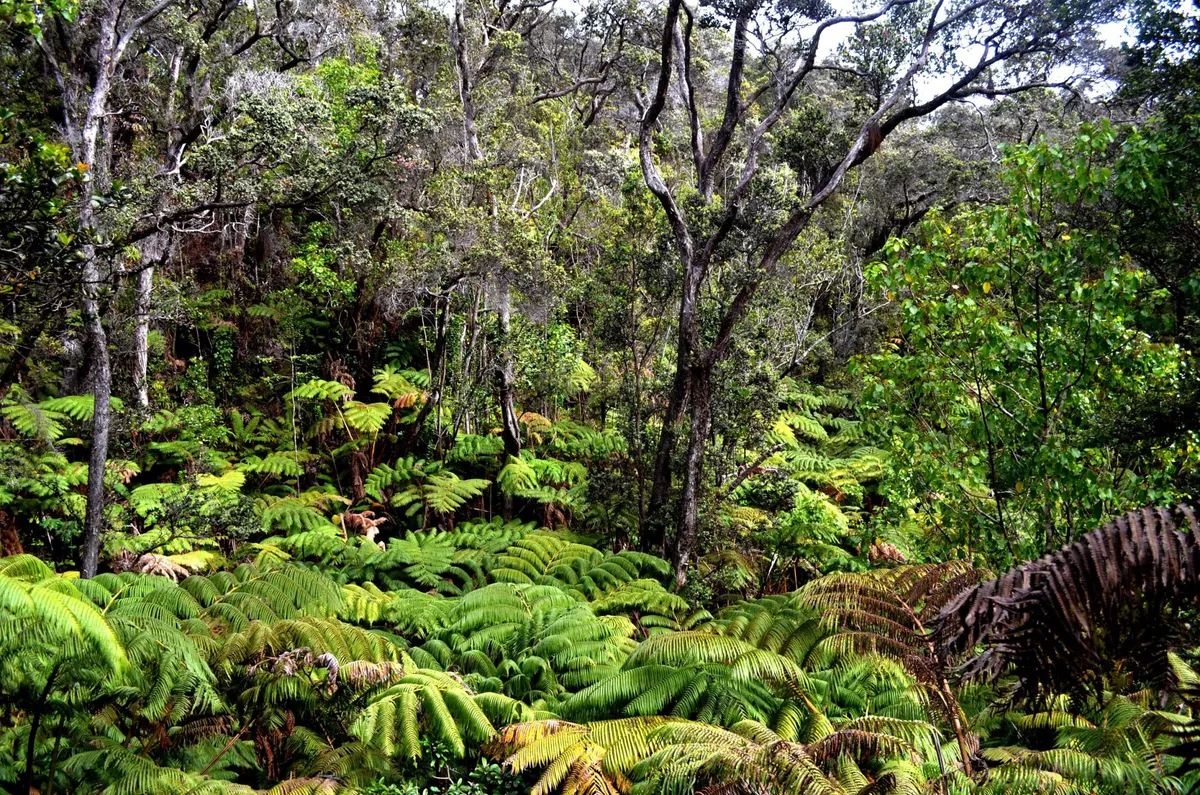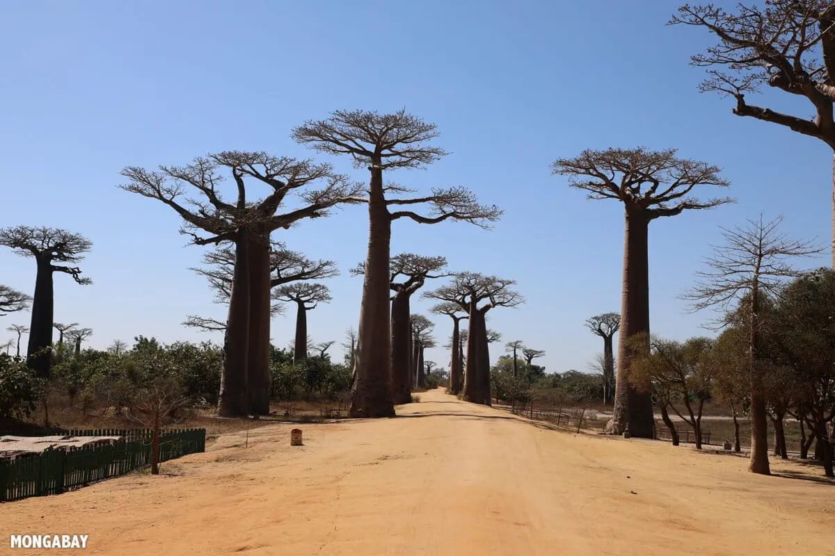
The forests of northeastern Gabon often look empty on modern conservation maps. Satellite images show vast green areas, classified as "intact forest landscapes." These areas are thought to be free from human disturbance.
However, the people of Massaha village know a different truth. They have been fighting to protect a rainforest south of their village. This forest, called Ibola Dja Bana Ba Massaha, is where they have hunted, fished, and farmed for generations. It holds sacred lakes, ritual sites, and the remains of ancestral villages. None of this appeared on official maps.
Mapping Ancestral Lands
A recent study looked into Massaha's efforts to map their territory. Researchers compared global conservation maps and old colonial maps with a detailed map created by the community. The study showed that the forest, which seemed empty on official records, was rich with history and meaning.
We're a new kind of news feed.
Regular news is designed to drain you. We're a non-profit built to restore you. Every story we publish is scored for impact, progress, and hope.
Start Your News Detox
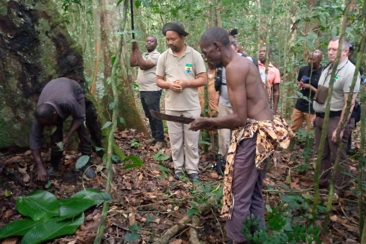
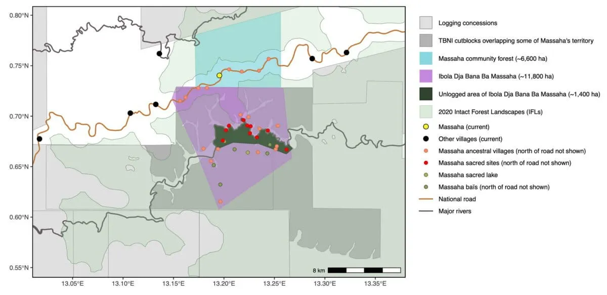
Massaha's map was created through a unique collaboration. Villagers projected satellite images onto a wall. Elders pointed out old settlements, sacred clearings, and fishing spots from their oral histories. Community members then walked the forest with GPS devices to confirm these locations. This process created a living map of their ancestral land, covering about 11,800 hectares.
This new map showed a stark difference from official records. Colonial maps from 1897 to the 1960s only showed a few villages nearby. Massaha's map documented fifteen ancestral villages in the same area. Sacred sites, lakes, and forest clearings important for wildlife were completely missing from earlier maps.
Community biocultural mapping of Ibola Dja Bana Ba Massaha: community-collected data on biocultural sites and territorial limits (north of the national road are not shown), presented along with available data on logging concessions, roads, rivers, and current villages. Also presented, for the purpose of this study, are 2020 Intact Forest Landscapes (IFLs)
Colonial maps focused on trade and control, tracking roads and resources, not the cultural geography of local communities. Modern global conservation maps, which rely on satellite data, also miss these details. They detect large-scale industrial activity but struggle to capture smaller details like hunting grounds or sacred groves.
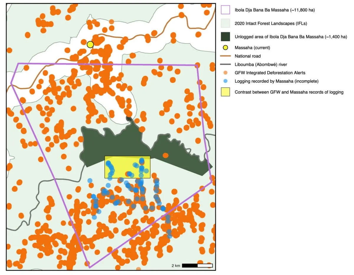
Massaha villagers found this out during their own patrols. They documented logging in areas where satellite alerts showed no activity. Relying only on global data would have suggested a much larger area of untouched forest than what truly existed.
Logging mapped by Massaha (a July 2023 community patrol), some of which was not detected by Global Forest Watch’s Integrated Deforestation Alerts (from August 16th, 2020, the first available data after Massaha submitted its request, to February 15th, 2025, the most recently available data as of analysis conducted on March 4th, 2025)
A Victory for Community Conservation
For Massaha, mapping became a powerful tool. They used their maps to show their long history in the territory. They argued that their forest should be removed from logging plans and recognized as a community-conserved area.
Their efforts gained traction. After independent reports highlighted the issue, international groups urged the government to investigate. When Gabon’s environment minister visited, he saw the former villages, sacred sites, and cultural landscape that logging threatened. Soon after, the government stopped logging and ordered the company to leave the disputed forest.
This event sparked a wider discussion in Gabon about recognizing "territories of life." These are lands managed and conserved by local people. This idea is becoming more important in global conservation, especially as governments aim to protect 30% of land and seas by 2030.
Massaha's experience shows that protecting these areas depends on local knowledge as much as on satellite data. Maps are powerful. They shape how we understand and manage landscapes. When global data portrays forests as empty, it risks ignoring the people who have lived there for centuries. Community mapping helps correct this, connecting conservation goals to real, lived landscapes.
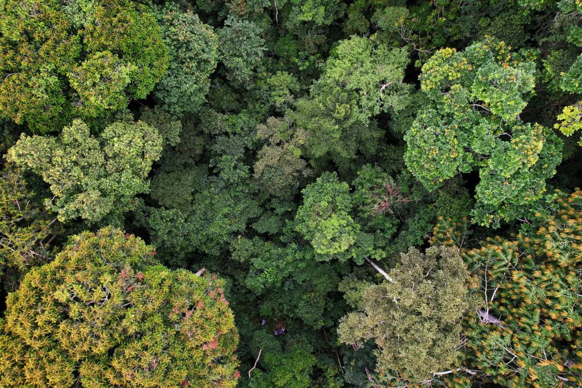
Left: Paraecologist and author Serge Ekazama Koto maps a previously undocumented bai, a swampy forest clearing important to biodiversity. Right: aerial view of Ibola Dja Bana Ba Massaha showing the issuaka (mature forest) south of the Liboumba (Abombwe) river. Near the river are many ancestral villages and sacred sites unmarked by colonial and global maps; the forest in the background was classified as within an Intact Forest Landscape (IFL) in 2020 but has since been logged. Photos by Guy Rodger Imbembi and Walter Mbamy
The forest around Massaha still holds traces of its past. Elders remember etoubili, a ritual fishing tradition using large canoes carved from bilinga trees. These canoes were buried in river mud for decades. Villagers recently unearthed them during ceremonies related to their fight to protect the forest.
To outsiders, the forest might seem untouched. But to Massaha's residents, it is full of memory. Their maps show that conservation often starts not with satellites, but with stories and the people who remember them.
Deep Dive & References
Community biocultural mapping reveals historical occupation and enables defense of African rainforests - Ambio, 2026