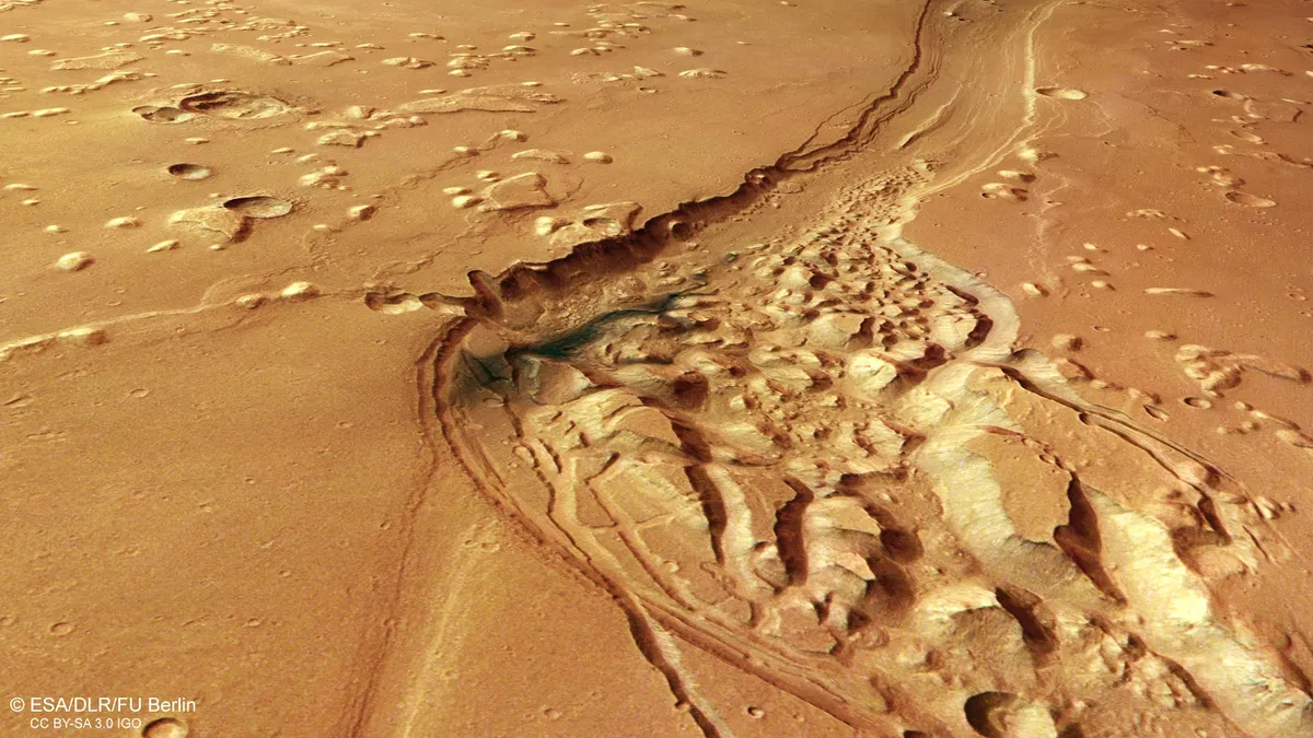
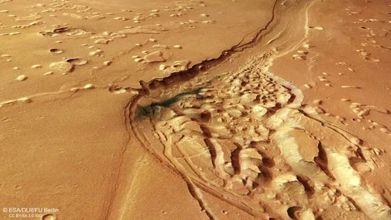
Ancient floods once carved the massive Shalbatana Vallis channel on Mars, reshaping the planet's surface. New images from the Mars Express mission reveal a chaotic landscape of craters, lava, and collapsed terrain. This area may hold clues about a lost Martian ocean.
ESA's Mars Express mission is focusing on Shalbatana Vallis this month. This striking Martian valley shows signs of ancient floods, volcanic activity, impact craters, and collapsed ground.
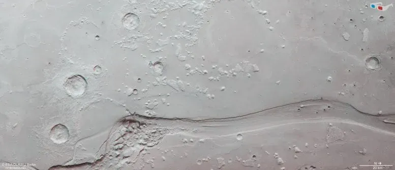
A Giant Valley Carved by Ancient Floods
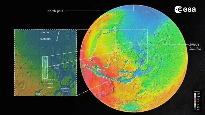
Shalbatana Vallis is near the Martian equator and stretches about 1,300 kilometers, similar to the length of Italy. The latest image from Mars Express's High Resolution Stereo Camera (HRSC) shows the northern part of the channel as it winds through the dusty surface.
We're a new kind of news feed.
Regular news is designed to drain you. We're a non-profit built to restore you. Every story we publish is scored for impact, progress, and hope.
Start Your News DetoxScientists believe Shalbatana Vallis formed about 3.5 billion years ago. Massive amounts of groundwater burst from beneath Mars's surface. These powerful floods quickly eroded the landscape, carving deep channels as the water rushed downhill.
The main valley is about 10 kilometers wide and 500 meters deep. These features are clearly visible in the topographic view.
Researchers think the valley was once deeper. Over time, sediments and other materials partly filled the channel. A dark blue-black patch in the rougher part of the valley is likely volcanic ash. Martian winds later moved this ash around.
Clues to Water and a Possible Ancient Ocean
Shalbatana Vallis is part of a larger network of outflow channels. This area marks the boundary between the heavily cratered southern highlands and the smoother northern lowlands.
Just beyond the image is Chryse Planitia, one of the lowest regions on Mars. Many of the planet's major outflow channels end there. This has led some scientists to suggest that Chryse Planitia might have once held a large ocean. This would have been during an earlier time when Mars was warmer and wetter.
Chaotic Terrain, Lava, and Craters
The landscape around Shalbatana Vallis has many geological features. Outflow channels on Mars are often linked to "chaotic terrain." This is a jumbled landscape of broken blocks, ridges, and rocky mounds.
In this region, chaotic terrain appears in the wider section of Shalbatana Vallis, near dark volcanic ash deposits. Scientists think these formations happened when underground ice melted, causing the ground above to shift and collapse.
Many impact craters are also visible. Some are partly buried, others have eroded, and several are surrounded by debris from the impacts.
Much of the surrounding terrain looks smooth, suggesting lava once flowed there. As the lava cooled, it formed uneven features called "wrinkle ridges." Isolated hills called "mesas" are also visible. These are remnants of older, higher surfaces that eroded over billions of years.
More Than 20 Years of Mars Exploration
The HRSC camera captured these images. It is one of eight scientific instruments on Mars Express. Since its launch in 2003, the spacecraft has spent over two decades studying Mars. It has mapped its surface in color and 3D with great detail. The mission has given scientists major insights into the planet's geological history and how it evolved.
The Mars Express HRSC was developed and is run by the German Aerospace Center (DLR). The DLR Institute of Space Research processed the camera data. The Planetary Science and Remote Sensing group at Freie Universität Berlin used this data to create the images.