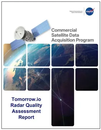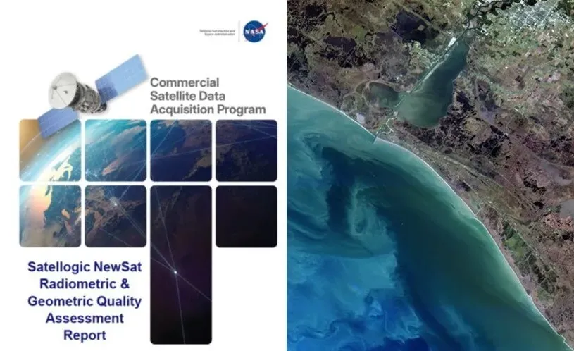
Good news for anyone who enjoys pictures of Earth from space, especially if those pictures come with a side of scientific rigor: NASA has officially given its stamp of approval to data from Satellogic's NewSat satellites.
Think of it as NASA saying, "Yep, these images are good enough for science." Which, considering we're talking about the agency that sends rovers to Mars, is no small compliment.
The Commercial Satellite Data Acquisition (CSDA) program, NASA's discerning eye for private-sector space data, just released a report on Satellogic's Mark IV and Mark V sensors. After poring over 60 images snapped between 2021 and 2025, their experts weighed in on everything from color accuracy to geometric precision.
We're a new kind of news feed.
Regular news is designed to drain you. We're a non-profit built to restore you. Every story we publish is scored for impact, progress, and hope.
Start Your News DetoxThe Verdict from Above
Turns out, Satellogic's data is pretty solid. Radiometric accuracy (basically, how well the satellites measure light and color) was strong, with most spectral bands chilling within 10% of NASA's own reference values. Over half the bands even hit a "Good" rating for signal-to-noise ratios, which, if you're into data, is quite satisfying.
Geometric performance (how accurately things are positioned in the image) also generally impressed, often outperforming the sensor's own specs. Though, in a classic tale of sibling rivalry, the Mark IV sensor snagged an "Excellent" grade, while its younger sibling, the Mark V, settled for a "Basic." Someone's got to work on their alignment.
Satellogic, ever the diligent student, has already started updating its data processing to iron out some of those kinks. NASA's CSDA is currently re-evaluating these improved products, so stay tuned for the sequel.
Why NASA is Playing Nice with the Private Sector
NASA's Earth Science Division created the CSDA program because, let's face it, there's a lot of cool stuff happening in commercial space. The goal is to scout, evaluate, and then purchase remote sensing data from private companies. This isn't just about getting more pictures; it's about turbocharging Earth science research and applications.
It's a clever move: NASA gets timely access to a growing trove of high-quality data without having to launch every single satellite themselves. And private companies get invaluable feedback from the world's foremost space agency, which encourages them to innovate even harder. It's a win-win, really, unless you're a satellite that can't quite hit its mark.
This collaboration isn't just about pretty pictures; it's about speeding up scientific discoveries and expanding how we use Earth observation data for everything from climate monitoring to disaster response. Because apparently, the more eyes we have on our planet, the better.