Good news for anyone who likes their weather forecasts to be, you know, accurate: NASA has officially given its stamp of approval to precipitation radar data from Tomorrow.io. This means a private company's eye-in-the-sky rain-tracking tech is now considered good enough for NASA's own scientific endeavors. Which, if you think about it, is both impressive and slightly terrifying for anyone still relying on a coin flip for their umbrella decisions.
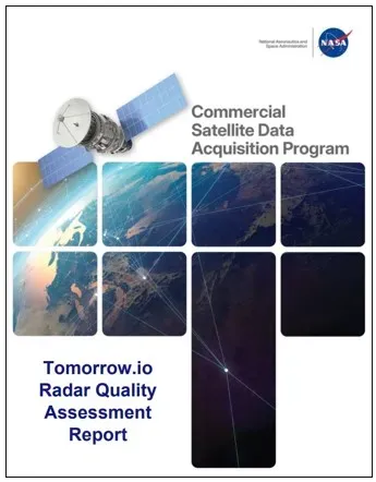
The official word came down in a report from NASA's Commercial Satellite Data Acquisition (CSDA) program, released March 9, 2026. Experts meticulously poked and prodded the data coming from Tomorrow.io's R1 and R2 spacecraft, specifically their Ka-band Precipitation Radars. Because apparently, even space-based weather data needs a quality check, much like your aunt's casserole.
The Nitty-Gritty on Rain Tracking
NASA's deep dive focused on Tomorrow.io's Level 2 Precipitation products and, crucially, how precisely they knew where on Earth that rain was falling. The verdict? Tomorrow.io's own analysis largely held up. The geolocation — essentially, pinpointing the raindrops — showed an "excellent correlation" of 0.98 when stacked against a digital elevation model. That's practically a perfect match, for those of us who don't speak fluent correlation coefficient.
We're a new kind of news feed.
Regular news is designed to drain you. We're a non-profit built to restore you. Every story we publish is scored for impact, progress, and hope.
Start Your News DetoxWhen compared to good old ground-based radar, the satellite data also looked solid. R1, one of Tomorrow.io's satellites, hit a correlation of 0.73, while R2, its slightly more accurate sibling, clocked in at 0.93. R2 also had a significantly lower bias, -6% compared to R1's -22%. What does this all mean? That NASA's eggheads are confident enough to use Tomorrow.io's data for their own science, provided it fits their specific research goals.
Rei Goffer, Tomorrow.io's Chief Strategy Officer and Founder, probably did a little happy dance. He noted that this NASA validation is a huge step, helping the broader scientific community trust commercial Earth observation data. He called it an opening of "a new chapter for Earth observation," which sounds dramatic, but when it comes to knowing if you need a jacket, it's pretty important.
Why NASA Cares About Commercial Data
NASA's CSDA program, cooked up by its Earth Science Division, is essentially a talent scout for commercial remote sensing data. Their mission: find, evaluate, and then buy this data to supercharge NASA's own Earth science research. Think of it as NASA outsourcing some of its data collection, because even space agencies appreciate a good deal and fresh perspectives.
This program isn't just about getting data; it's about nurturing the growing private sector in space. By working with these companies, NASA aims to accelerate scientific discoveries and expand how we use Earth observation data for, well, everyone's benefit. Since its inception, the CSDA program has refined its evaluation process, using expert-led assessments to speed things up and strengthen ties with the commercial data industry. Because in the future, knowing if it's going to rain might just come from a startup.