A satellite can see a waterlogged field from 400 miles up. The trick is turning that view into something a farmer can actually use before planting season ends.
That's what OPERA — the Observational Products for End-Users from Remote Sensing Analysis project — does. Launched by NASA's Jet Propulsion Laboratory in 2021, it takes raw satellite data and transforms it into maps that farmers, water managers, and government agencies can act on immediately, without needing a PhD in remote sensing to interpret it.
Water that won't drain
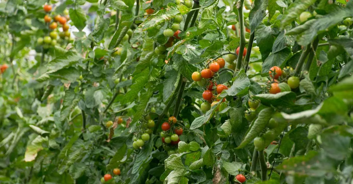
In central Iowa's South Fork watershed, researchers at the USDA's National Laboratory for Agriculture and the Environment spotted a problem: water pooling in the same spots year after year. Those soggy patches don't just reduce crop yields — they signal deeper soil issues and create hotspots where carbon and nutrients accumulate in ways that hurt long-term productivity.
We're a new kind of news feed.
Regular news is designed to drain you. We're a non-profit built to restore you. Every story we publish is scored for impact, progress, and hope.
Start Your News DetoxUsing OPERA's satellite products, scientists created detailed maps showing exactly where water lingers from May through October. The data reveals not just standing water, but patterns: which depressions flood consistently, how vegetation responds, even how rivers shift their course after storms. A farmer looking at these maps can see, in color-coded pixels, which parts of their field need better tile drainage — the underground pipe systems that move water away from roots.

Figure 3. The map depicts a field south of Iowa Falls in Hardin County, IA. The pixels are color-coded to indicate the number of times a region is inundated with water from May through October 2024.
This matters because better drainage means healthier soil, which means higher yields. It also means smarter conservation — you're not draining land that doesn't need it. The same satellite data that tracks water also monitors vegetation health and detects surface disturbance, giving watershed managers a complete picture of how land and water interact across entire regions.
OPERA launched because federal agencies kept asking NASA the same question: we have satellite data, but it's too raw to use. We need it processed, standardized, and ready to plug into our existing systems. The White House Office of Management and Budget convened a working group to identify those needs, and OPERA was the answer.
As of 2025, the project has released three product suites — surface water extent, surface disturbance, and surface displacement data — all freely available through NASA's data centers. A fourth product measuring vertical land motion (useful for tracking subsidence and coastal flooding risk) launches in 2028.
The Iowa case study shows what's possible when satellite technology meets ground-level problems. A farmer doesn't need to understand cloud processing or synthetic aperture radar. They need a map. OPERA provides it.