For years, scientists could only guess how deep Lake St Clair really was. The estimates ranged wildly—somewhere between 160 and 215 meters—which is the kind of uncertainty that keeps researchers up at night. Now, thanks to a team from CSIRO (Australia's national science agency), that question is settled. Lake St Clair in Tasmania's central highlands reaches a maximum depth of 163 meters, making it definitively Australia's deepest lake. The next deepest doesn't even come close—it's less than 100 meters.
The precision matters. Not just for trivia, but because understanding a lake's true structure opens doors to studying how it formed, what lives in it, and how to protect it.

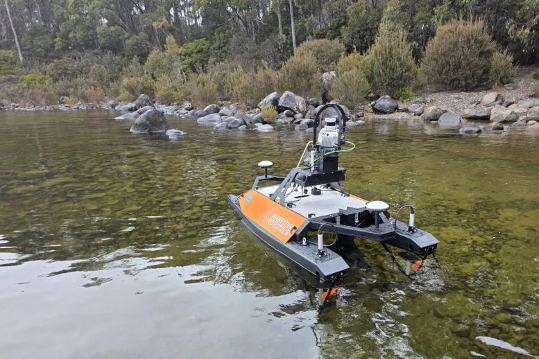
Sonar and lasers mapped what divers never could
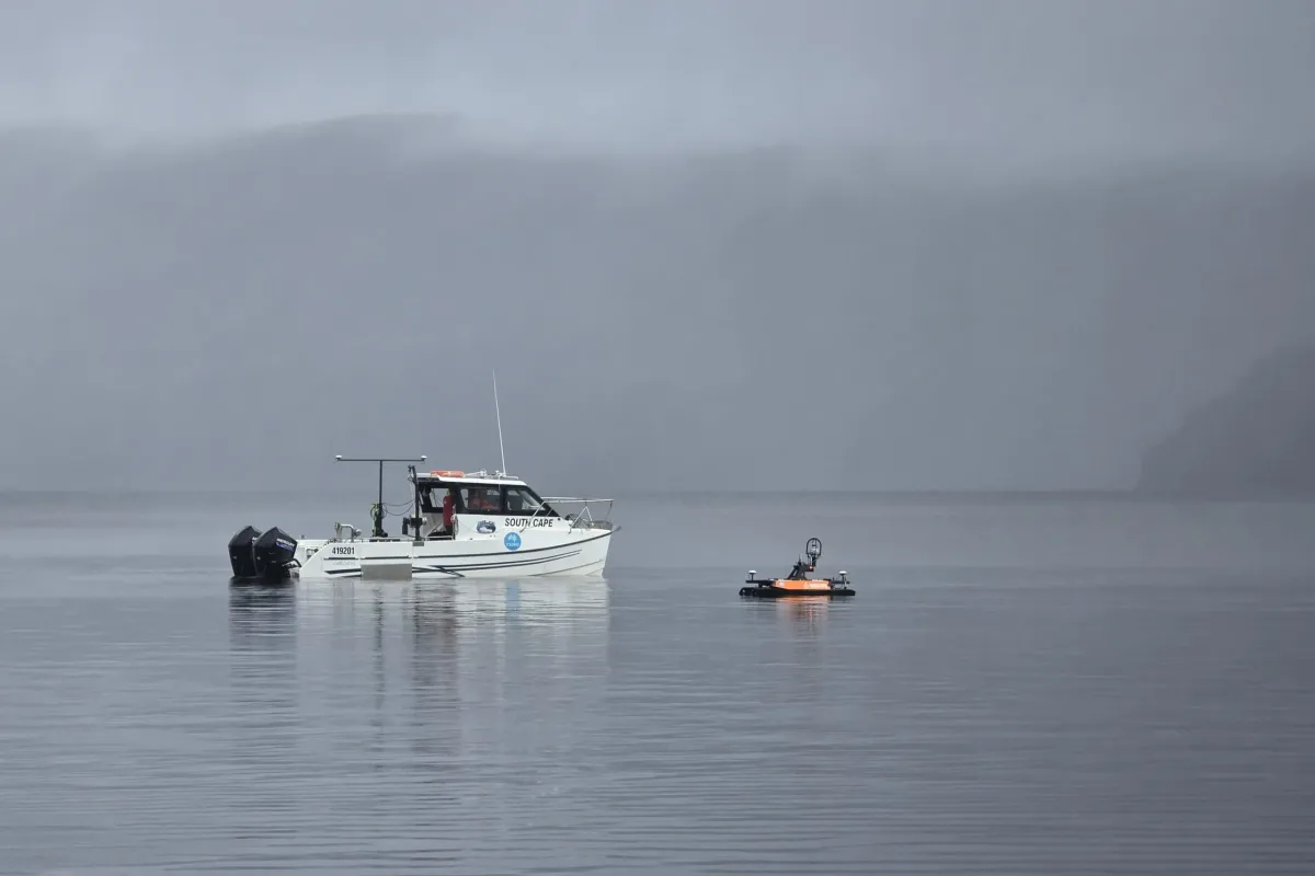
The CSIRO team spent eight days surveying the entire lake using a combination of multibeam sonar and LIDAR (Light Detection and Ranging)—essentially using sound waves and lasers to see through water and build a 3D model of the lakebed. They deployed two vessels: the RV South Cape, a proper eight-meter research boat, and the Otter, a two-meter unmanned drone that could slip into shallow areas where the bigger boat couldn't go.
We're a new kind of news feed.
Regular news is designed to drain you. We're a non-profit built to restore you. Every story we publish is scored for impact, progress, and hope.
Start Your News Detox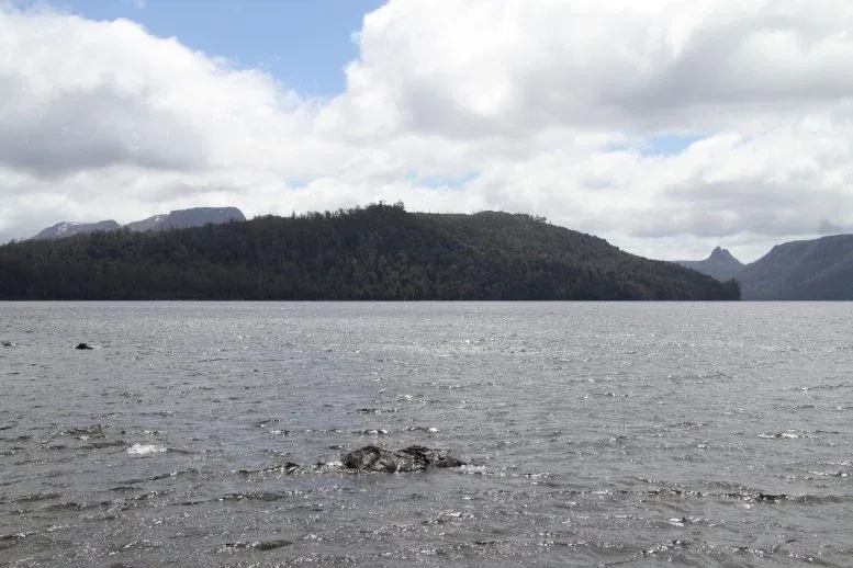
The multibeam sonar works by pinging the lake floor with sound pulses and timing how long the echoes take to return. Simple in concept, but the resolution is wild—the resulting map can spot objects as small as 50 centimeters in some places. That's not just accurate; that's almost absurdly detailed for an underwater survey.
The deepest point sits close to the western shore, about four kilometers north of the visitor center, on a bend in the lake. But that 163-meter spot isn't alone—several other areas plunge to 150 meters, revealing a much more dramatic underwater landscape than anyone expected.
What they found below the surface
The high-resolution map revealed features no one had seen before: steep submerged cliffs, deep channels, large rock structures, and fallen trees scattered along the shoreline. There are also several mysterious features on the lakebed that have researchers curious about their origins—though the map, unfortunately, doesn't confirm the existence of a Lake St Clair "Loch Ness" monster.

Lake St Clair was carved by glaciers long ago, and today it's part of the UNESCO World Heritage-listed Cradle Mountain Lake St Clair National Park. CSIRO plans to release the full 3D dataset to researchers and environmental managers, which should help scientists understand the lake's formation, study its underwater habitats, and improve safety for boats operating on the water. The data might even support testing of autonomous underwater vehicles in the future.
For a lake that's been around for thousands of years, we're only now getting a proper look at what's underneath.