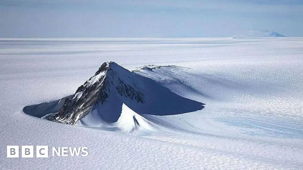
Beneath three miles of ice, Antarctica holds a landscape no human has ever seen. Now, researchers have mapped it in detail that rivals a high-resolution photograph — revealing thousands of hills, ridges, and channels that could reshape how we predict the continent's future.
The breakthrough comes not from drilling or ground surveys, but from a clever reading of the ice itself. Scientists combined satellite data showing the ice surface with an understanding of how glaciers move. Where ice flows differently, it hints at what lies underneath — like ripples on a river revealing hidden rocks below.
"It's like before you had a grainy pixel film camera, and now you've got a properly zoomed-in digital image of what's really going on," said Dr. Helen Ockenden, lead researcher at the University of Grenoble-Alpes.
We're a new kind of news feed.
Regular news is designed to drain you. We're a non-profit built to restore you. Every story we publish is scored for impact, progress, and hope.
Start Your News DetoxTraditional radar surveys from aircraft and ground stations could only peek through the ice at scattered points tens of kilometers apart. Scientists had to guess what lay in between. The new approach fills those gaps across the entire continent, uncovering tens of thousands of previously unknown features: hills, ridges, and one particularly striking discovery — a channel in the Maud Subglacial Basin that runs nearly 400 kilometers long, averages 6 kilometers wide, and cuts 50 meters deep into the bedrock.
Why this matters for the future
These hidden landforms aren't just curiosities. They shape how fast glaciers move and how quickly they collapse as the climate warms. A glacier flowing over a ridge behaves differently than one flowing over smooth ground. Understanding the terrain means better computer models — and better predictions of how much Antarctic ice will melt and how much sea levels will rise.
"This gives us a better picture of what's going to happen in the future and how quickly ice in Antarctica will contribute to global sea-level rise," said Dr. Peter Fretwell of the British Antarctic Survey.
The map isn't perfect — it relies on assumptions about ice flow that carry some uncertainty. But other researchers agree it's a significant step forward, filling the blank spaces in our understanding of one of Earth's most consequential landscapes. The study appears in Science.
As climate models become more detailed, so does the possibility of better preparing for what comes next.