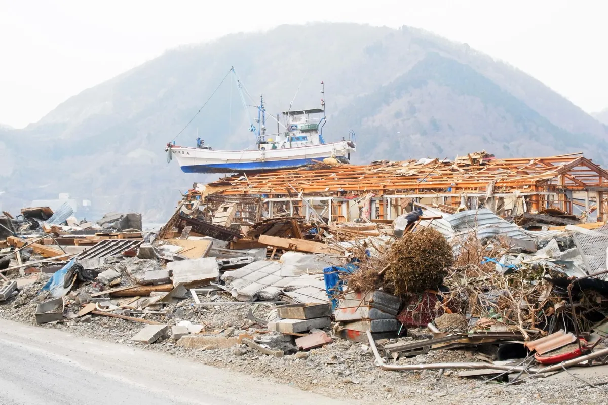
Scientists drilling nearly five miles into the Pacific seafloor have uncovered why the 2011 Tōhoku earthquake did something seismologists thought impossible: rupture so close to the ocean surface that it shoved the seafloor upward with enough force to spawn a devastating tsunami.
The answer lies in a fragile layer of pelagic clay—a slippery, sediment-rich band just 100 feet thick that runs for hundreds of miles beneath the Japan Trench. When the earthquake struck, this weak layer acted like a natural tear line, allowing the rupture to race all the way to the seafloor instead of stopping deeper down where it would cause far less damage.
"That's equivalent to the entire area between Los Angeles and San Francisco moving 130 to 200 feet in just six minutes," said Christine Regalla, an associate professor at Northern Arizona University who led the drilling expedition. "We've never seen anything like that in the time we've been observing earthquakes."
We're a new kind of news feed.
Regular news is designed to drain you. We're a non-profit built to restore you. Every story we publish is scored for impact, progress, and hope.
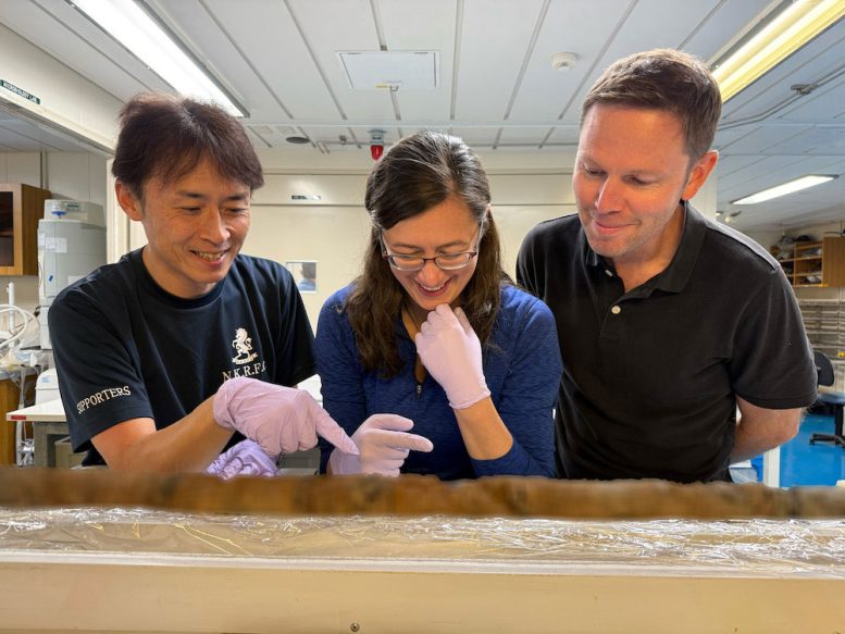
Start Your News DetoxThe discovery came from an ambitious offshore project that earned a Guinness World Record. Regalla's team drilled 26,000 feet into the ocean floor aboard the research vessel Chikyu, recovering core samples that revealed the clay layer's critical role. The pelagic clay forms over millions of years from microscopic particles settling on the seafloor, and with stronger rock layers above and below it, the material becomes an extremely focused, extremely weak surface—exactly the kind of geometry that lets earthquake ruptures propagate toward the surface.
Why This Matters Beyond Japan
The findings suggest that other subduction zones around the world—places where oceanic plates sink beneath continental ones—may harbor similar weak layers that make shallow, tsunami-generating earthquakes more likely than previously thought. This isn't a local concern. A tsunami spawned in Japan travels across the entire Pacific. Hawaii's most devastating tsunamis come from Japanese and Alaskan earthquakes. A major rupture in one region ripples across borders and oceans, affecting ports, communities, and economies thousands of miles away.
Regalla's work offers policymakers a concrete tool: by identifying which coastlines sit above these vulnerable geological layers, communities can revise building codes, strengthen critical infrastructure, and refine evacuation plans before the next major earthquake strikes. Japan, already a global leader in earthquake preparation, wasn't ready for 2011. The goal now is to ensure that the next vulnerable region doesn't face the same surprise.
"We all need to gain a better understanding of where these events might happen in the future," Regalla said. "Only then can we make emergency plans that will keep everyone safe."
The research opens a pathway for seismologists to map high-risk zones more accurately—not to predict earthquakes, which remains impossible, but to identify where the geology itself makes catastrophic shallow ruptures more probable. That knowledge, combined with better preparation, may be the closest we can get to preventing the next tsunami.