Salt marshes are quietly doing some of the planet's most important climate work. These coastal wetlands store carbon at rates that rival tropical forests, yet they've been nearly invisible in global climate accounting — until now.
A research team from China's Institute of Atmospheric Physics has built the first model specifically designed to measure how much carbon salt marshes actually capture. It's a breakthrough that fills a gap scientists have been wrestling with for years: traditional carbon models were built for forests and grasslands, not for the salty, tide-soaked ecosystems where some of Earth's most productive plants grow.
Why Salt Marshes Matter (And Why We Missed Them)
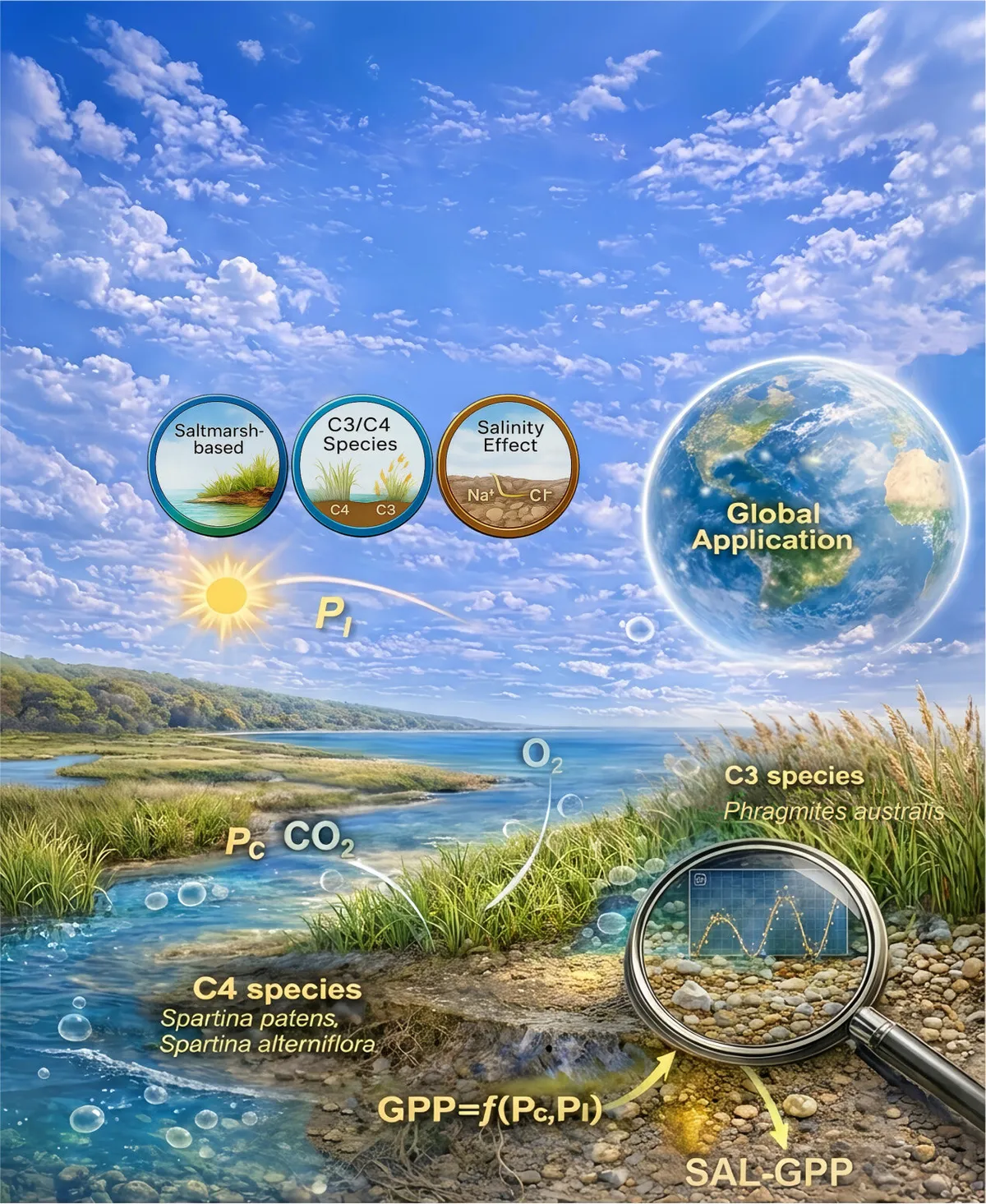
The new model, called SAL-GPP, does something previous tools couldn't: it accounts for salt stress and tidal patterns. Salt marsh plants have to work differently than their inland cousins — they're constantly managing saltwater exposure, which changes how efficiently they photosynthesize. The model simulates this for both C3 and C4 plants across different salinity levels, capturing the real complexity of these ecosystems.
We're a new kind of news feed.
Regular news is designed to drain you. We're a non-profit built to restore you. Every story we publish is scored for impact, progress, and hope.
Start Your News Detox"Salt marshes are among the most efficient blue carbon ecosystems on Earth," says Prof. Li Tingting, who led the research published in Environmental Science & Technology. "But previous global carbon assessments have largely missed coastal wetland contributions due to model limitations."
The team tested SAL-GPP against real-world data from flux towers worldwide and found it accurately predicted daily productivity with an R² of 0.82 — meaning it captures the actual patterns of how much carbon these plants are pulling from the atmosphere.
Using this model, the researchers created the first high-resolution global map of salt marsh productivity, covering 2011 to 2020. The numbers are striking: global salt marshes sequester about 67 trillion grams of carbon annually. That's not uniformly distributed — hotspots in the southeastern United States, Western Europe, China's southeastern coast, and Australia account for nearly two-thirds of the global total.
This matters because it's not just academic precision. When countries calculate their carbon budgets and climate pledges, they're working with incomplete data. Salt marshes have been the missing piece. Now that scientists can measure their contribution accurately, these ecosystems can finally be factored into the climate accounting that shapes policy and investment.
The model's accuracy also outperforms mainstream satellite-based tools like MODIS and remote sensing products that have been the standard for decades. That means future carbon estimates will be more reliable — and more likely to reflect the actual role coastal wetlands play in slowing climate change.
What's next is integration. As countries refine their national carbon inventories and scientists build more complete climate models, salt marshes will no longer be an afterthought. The data is there now. The question is whether we'll protect these ecosystems with the same urgency we've started to give mangrove forests and seagrass beds.