Scientists have found a huge, hidden freshwater system beneath the Great Salt Lake. This discovery came from airborne electromagnetic (AEM) surveys. These surveys looked deep below the lake's surface.
The findings challenge old ideas about how freshwater and saltwater mix in places like this. This new information could help us understand groundwater flow better and find solutions for environmental issues.
Mapping the Hidden Water
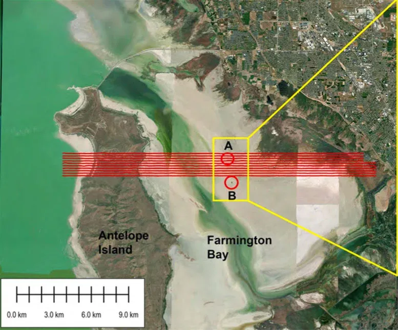
Researchers used AEM surveys to map the ground under Farmington Bay and Antelope Island, on the lake's southeastern side. Geophysicists at the University of Utah studied this data. They found freshwater saturating sediments up to 3 to 4 kilometers (about 1.9 to 2.5 miles) deep.
We're a new kind of news feed.
Regular news is designed to drain you. We're a non-profit built to restore you. Every story we publish is scored for impact, progress, and hope.
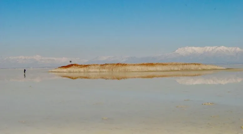
Start Your News DetoxThis helicopter-based survey followed earlier observations. Scientists had seen freshwater rising under pressure in Farmington Bay. This formed unusual mounds covered in tall phragmites reeds.
Michael Zhdanov, the lead author, said this study is the first to show that AEM can find freshwater under a thin layer of salty water. His team also mapped how far the freshwater goes under Farmington Bay. They estimated the depth of the water-filled sediments by finding the bedrock below.
Zhdanov, a professor of geology and geophysics, explained that knowing the depth, width, and porous space allows them to calculate the potential volume of freshwater.
These findings were published in Scientific Reports. This work is part of a larger project by the University of Utah. It aims to understand groundwater beneath the Great Salt Lake, the largest terminal lake in the Western Hemisphere.
Unexpected Water Flow
The results show that freshwater is moving into the ground towards the lake's center. This is different from what scientists usually expect, which is water entering from the edges.
Hydrologist Bill Johnson, a co-author, noted that the surprising part was how far the freshwater extends towards the lake's interior. He said they don't know if it goes under the entire lake. Normally, hydrologists would expect the denser brine to fill the entire area under the lake. They would expect freshwater from the mountains to enter at the edges. Instead, it's coming in towards the center.
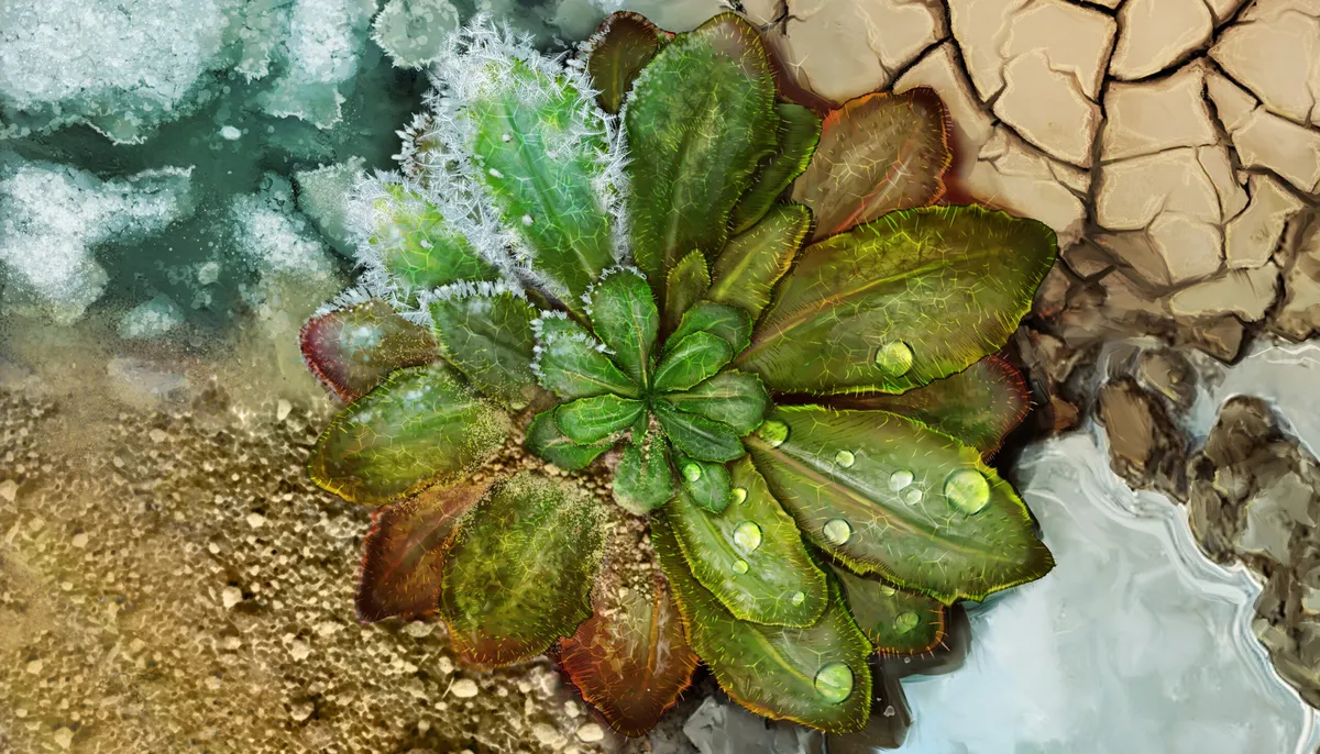
Interest in this phenomenon grew when circular mounds started appearing on the dry lakebed. Each mound is about 50 to 100 meters (roughly 164 to 328 feet) wide and covered with tall reeds. The lake's water levels have dropped, exposing about 800 square miles of lakebed. This exposed area is now a major source of dust pollution for nearby communities.
Environmental Solutions
Johnson, a professor of geology and geophysics, is looking into whether this underground freshwater could help reduce dust emissions. These emissions contain toxic metals.
He explained that understanding this groundwater is important before extracting it. A main goal is to see if this freshwater can wet dust hotspots. This could help control dust without harming the freshwater system too much. Johnson believes this is a practical way to deal with dust spots that appear at higher elevations, as it's unlikely Farmington Bay will be completely refilled.
Johnson and his team are seeking funds to expand their research across a larger part of the lake.
How the Surveys Worked
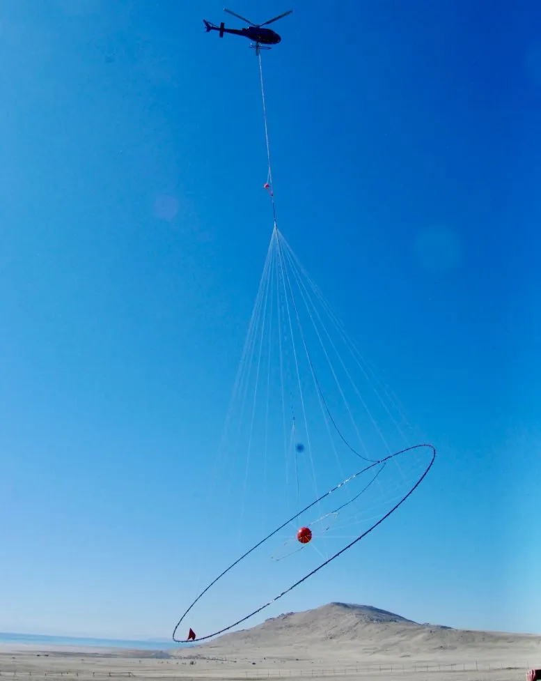
The study measured electrical resistivity down to about 100 meters (approximately 328 feet) using AEM surveys. This helped tell freshwater apart from more conductive brine. In February 2025, a Canadian geophysical team flew equipment suspended from a helicopter. The aircraft completed 10 survey lines across Farmington Bay and northern Antelope Island, covering 154 miles.
This data helped researchers map the boundary between saltwater and freshwater. For example, one phragmites mound sits where freshwater rises through a break in the layer beneath the lake.
Zhdanov explained that red areas on the map mean very conductive (salty water), and blue areas are resistive (freshwater). He noted that the surface shows saline water, but 10 meters underneath, resistive freshwater is clearly visible everywhere.
3D Imaging and Future Research
Zhdanov's team at CEMI created 3D images of the ground by combining AEM data with magnetic measurements. This produced a detailed image deep beneath Farmington Bay. It showed important features of its geology and groundwater.
Magnetic data showed that the bedrock beneath Farmington Bay is shallow, less than 200 meters (about 656 feet) deep. Then it drops sharply to 3 to 4 kilometers (about 1.9 to 2.5 miles). This change happens under a phragmites mound and marks a major structural boundary that needs more study.
Zhdanov believes similar airborne surveys could cover the entire 1,500 square miles of the Great Salt Lake. A full survey could help with water resource planning and guide efforts to find freshwater under other terminal lakes worldwide.
Deep Dive & References
Airborne geophysical imaging of freshwater reservoir beneath the eastern margin of Great Salt Lake - Scientific Reports, 2026