
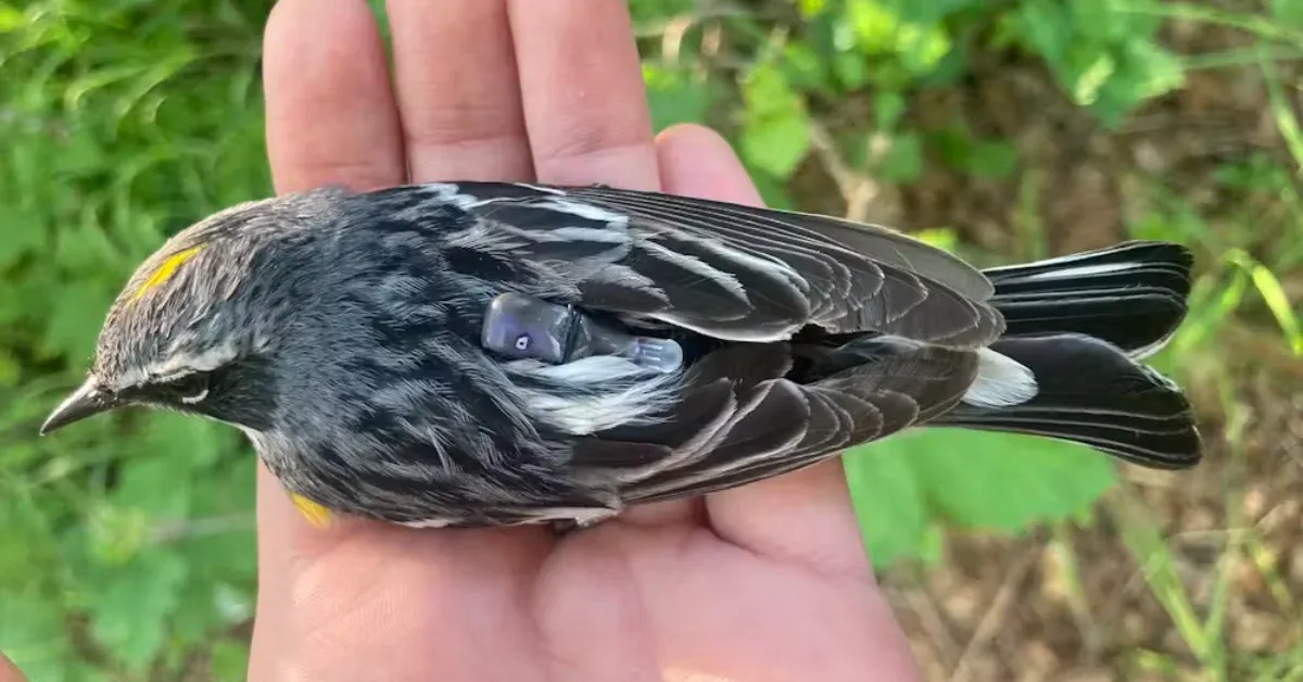
Imagine spending a year waiting for a Tic Tac-sized backpack to return. That's essentially what a Ph.D. researcher did, squinting through binoculars, hoping to spot a tiny yellow-rumped warbler. Not just any warbler, mind you, but one she'd banded a year prior, now carrying a miniature multi-sensor geolocator.
She played a warbler's song, luring a territorial male into a nearly invisible mist net. Gently, she retrieved the bird, and there it was: a tiny device on its back, packed with a year's worth of data from a 6,800-mile journey from Anchorage, Alaska, to an unknown wintering spot and back again. Because apparently, that's where we are now: putting backpacks on birds to solve ancient mysteries.
The Evolution of Feathered Tracking
Tracking these minuscule fliers has always been a bit of a logistical nightmare. Back in the '60s, scientists used radio telemetry, which involved actual people following birds, sometimes in small planes. Think of it as a very slow, very avian police chase.
We're a new kind of news feed.
Regular news is designed to drain you. We're a non-profit built to restore you. Every story we publish is scored for impact, progress, and hope.
Start Your News DetoxGPS came along in the early 2000s, but satellite tags were too heavy for most songbirds, many of whom weigh less than a spoonful of sugar. Which, if you think about it, is both impressive and slightly terrifying.
Then came the light-level geolocators: minuscule tags with a battery, clock, computer chip, and light sensor. They store data internally, meaning scientists had to recapture the birds a year later. These tags estimate location based on sunrise and sunset times, which is clever, but can be off by hundreds of miles. Around the equinoxes, when day length is uniform globally, it's basically a shrug emoji in terms of precision.
Enter the new kid on the block: barometric geolocators. These multi-sensor marvels record atmospheric pressure, which drops sharply when a bird flies higher during migration. This gives researchers the exact departure and arrival times for every single stop. When the bird isn't flying, the pressure data reveals its elevation, helping to pinpoint its location. Combine that with global weather data and a computer program called GeoPressureR, and you've got a "pressure fingerprint" for a specific spot. Add light and wind data, and suddenly, you know more about a bird's travel plans than your own.
Alaskan Warblers Take the Scenic Route
Researchers deployed these new backpacks on myrtle warblers, a type of yellow-rumped warbler that breeds across North America's boreal forest. The big question: where do the Alaskan populations go for winter? Ornithologist Richard McGregor, way back in 1899, thought he'd seen them wintering in coastal California.
Turns out, the warblers had other plans. Instead of the expected Pacific Coast route, all the tracked birds traveled east across Canada's boreal forest, then shifted south to the Gulf Coast. That's a roughly 6,800-mile round trip – far longer than expected for a species typically considered a short- or medium-distance migrant. Talk about taking the scenic route.
This seemingly indirect path isn't unique to the warblers; other northwestern songbirds do it too. Scientists suspect it's a ghost of glaciers past. Millions of years ago, glaciers pushed bird populations south. As the ice melted and forests returned, birds slowly expanded their breeding grounds north and west. Their migration routes, genetically programmed like ancient GPS coordinates, simply followed this expansion. The glaciers are long gone, but the birds still fly the original breadcrumb trail.
While the 1800s California-wintering warblers remain a bit of a mystery, future research might involve tagging birds directly in California. Because if there's one thing we've learned, it's that these tiny birds have some surprisingly complicated travel itineraries.
This new level of precision isn't just for curiosity's sake. More accurate location data helps identify crucial stopover and wintering sites for conservation, understand migration timing, and even assess collision risks with buildings or wind turbines. Each mapped journey helps us understand how these small birds navigate their world, and how we can better protect them. It's a lot of insight for a device the size of a breath mint.